
Alta Via del Sale by Gravel Bike: Our Full Guide (2026)
Reading time: 6 minutes · Last updated: August 1, 2026
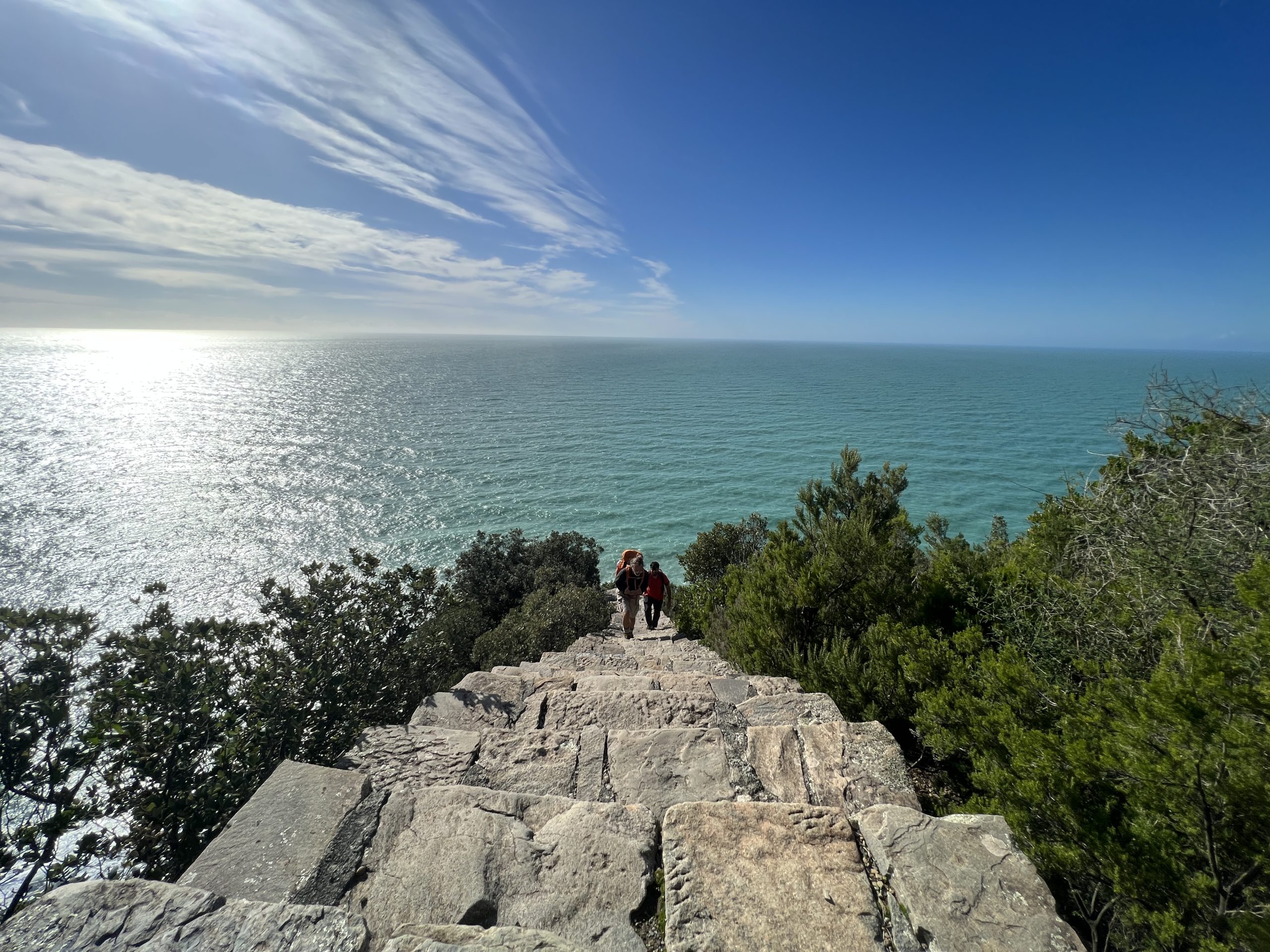
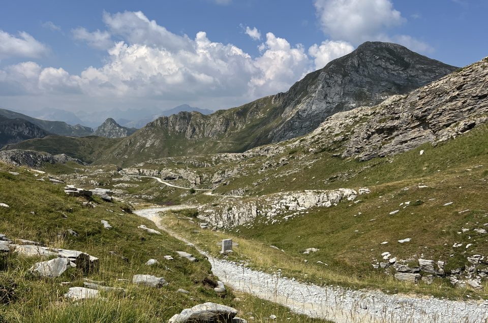
There's a moment, just past the border ridge, when the white military road stops being a simple track and becomes something else: a thread stretched between two worlds. On one side, the Maritime Alps, still cold at that altitude. On the other, far below, the blue of the Mediterranean you can sense long before you actually see it.
The Alta Via del Sale links Limone Piemonte to the sea at Ventimiglia along a historic military dirt road that winds between 1,800 and 2,100 metres, right on the Italian-French border. We rode it recently, over two days, on gravel bikes. This guide covers everything we wish we'd known before setting off, verified against the official route information wherever possible.
The Route in Brief
The "Alps to the Sea" itinerary, via Pigna, is listed by the official Alta Via del Sale website as suited to experienced cyclists. Here's the route at a glance:
- Distance: approximately 112 km, Limone Piemonte to Ventimiglia
- Elevation: +2,744 m gain / -3,556 m loss
- Highest point: 2,250 metres
- Recommended duration: 1 to 2 days
You can ride the whole thing in a single day, since it's "only" about 110 km and a well-trained cyclist will handle it comfortably. Alternatively, you can split it into two stages with an overnight stop in a mountain refuge, which is what we did.
Getting There: Park in Ventimiglia, Then Take the Train
We left our car in Ventimiglia and caught the first train of the day on the Cuneo–Ventimiglia line, also known as the historic Tenda line, at 06:18. We arrived in Limone Piemonte around two and a quarter hours later. From there, we rode down towards the sea until we were back at our car at the starting point. It's a simple, efficient way to ride the route point-to-point without arranging a separate return trip.
Bring your ID. The railway line crosses into French territory, around Tende and Breil-sur-Roya, before returning to Italy. Always carry a valid identity document, since spot checks along this stretch are possible.
Tuesdays and Thursdays: The Best Days to Go
One detail that's easy to overlook, yet genuinely important: the official regulations close the road to motorised traffic for the entire day on Tuesdays and Thursdays, while it stays open to pedestrians and cyclists every day. If you can choose, start on one of those two days. Riding the white road without cars, motorbikes, and quads along the most exposed sections changes the experience completely.
The road's seasonal opening and closing dates, tied to snowmelt and generally running from early summer into autumn, change every year. Therefore, always check the official website before you go.
What Bike to Bring
We rode it on gravel bikes, and some sections are genuinely rocky, so solid bike-handling skills on loose, uneven terrain are essential. On a mountain bike, it's the same route, but with noticeably more margin for error in the technical sections. There are also several exposed sections, with real drop-offs right at the edge of the road. Consequently, this is not a route for anyone with a fear of heights or vertigo.
Where to Sleep — and Where to Stop for Lunch
We stayed at Rifugio Allavena. Other cyclists riding the Alta Via also recommend Rifugio La Terza, on the opposite side of the route, towards Monesi di Triora.
- Rifugio Allavena (Colla Melosa, where we stayed) — dorm room, shared bathroom, good hot shower, decent dinner, honest prices, good draft beer. Around €60 per person, half board.
- Rifugio La Terza (Monesi di Triora) — recommended by other cyclists on the route. Around €80 per person, half board.
Prices can change seasonally, so always confirm directly with the refuge when booking.
For lunch along the way, Rifugio Don Barbera is a well-placed stop. Perched at Colle dei Signori (2,079 m), at the foot of Punta Marguareis, it's a historic waypoint on the Via del Sale, known for genuine home-style cooking, with vegetarian and dietary options available on request.
The Hidden Fort the Official Track Skips
Shortly after leaving Limone Piemonte, once you reach the Le Marmotte chalet-refuge, the official Alta Via del Sale track continues straight ahead. However, it's worth a short detour: continuing a little further gets you to Forte Centrale, also known as Forte di Colle Alto, one of the nineteenth-century fortifications on Colle di Tenda. It only takes a few extra minutes, and the view alone makes the detour worthwhile.
Two Spots Where the Official GPX Track Gets It Wrong
Based on our own experience, the track downloadable from the official website has two mistakes worth knowing about before you set off:
- The descent before Pigna: at one point the track veers left onto an old path through olive-grove terraces. Avoid it — we ended up there and had to push our bikes by hand for about 20 minutes. Stay on the main road instead.
- After Dolceacqua: the track keeps you on the main road, but a quiet, scenic bike path through the Nervia valley has since been built, running all the way to the beach in Ventimiglia. It's a far better ride than the road, so take that instead.
The Bottom Line
The Alta Via del Sale is one of the best gravel rides we've done in years. Landscapes change completely within hours, from alpine rock to Mediterranean scrub, and historic forts and welcoming refuges punctuate the way. Above all, there's real satisfaction in riding a bike all the way to the sea. It demands trained legs, a well-handled bike, and a bit of planning, but every pedal stroke pays off. If you're after more gravel ideas, we've also put together our free downloadable gravel routes in Tuscany.
Frequently Asked Questions
How many days does the Alta Via del Sale take by bike?
The full Limone Piemonte–Ventimiglia route is about 110-112 km. A trained cyclist can ride it in a single day, or split it over two days with an overnight stop at a refuge roughly halfway.
Gravel bike or mountain bike, which is better?
Both work. A gravel bike demands more technical handling on the rocky sections, while a mountain bike gives more safety margin on the same route.
When is the road closed to cars?
Every Tuesday and Thursday, the road is reserved for pedestrians and cyclists, with no motorised traffic at all — the best days to ride it.
Where can you sleep along the route?
There are several mountain refuges along the way, including Rifugio Allavena at Colla Melosa and Rifugio La Terza near Monesi di Triora, both offering half-board accommodation.
How do you get to Limone Piemonte without moving your car?
You can leave your car in Ventimiglia and take the Cuneo-Ventimiglia train line up to Limone Piemonte, then ride back down to your starting point.
Want to ride the Alta Via del Sale with proper support? If this route has caught your interest but you'd rather have logistical support, a support vehicle, or a guide along the way, we can put together a tailor-made trip across the Alps and Liguria for you. Browse the rest of our tours, or get in touch through our contact form at info@outoftheboxflorence.com / WhatsApp +39 347 080 9904.
Contenuto elaborato con l'ausilio dell'IA · fonti web verificate — Out of the Box Florence